Publications

OGD Wikimedia OpenStreetMap Checker
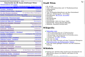
I wrote a small tool that helps to synchronize OGD data sets with Wikimedia (Wikipedia, Wikimedia Commons, Wikidata) and OpenStreetMap. It can be found on this server: https://www.openstreetmap.at/checker.
Since the tool is not entirely self-explanatory, I made a small explanatory video:
https://www.youtube.com/watch?v=e9Is-3ssA7U
The source code can be found on Github. I welcome comments, ideas and code contributions!
Update: Meanwhile, there is a second screencast for this program, this time it is about how to install the checker yourself and how to expand it with additional data sets:

ÖRK/MSF Mapathon World Water Day
At ‘mapping parties’, volunteers help to put neglected crisis regions on the map. This data is important for the work of aid organisations so that they can react faster and in a more targeted manner in the event of a crisis. The Red Cross and Médecins Sans Frontières are jointly organising a mapathon on 22 March to mark World Water Day.
Who can participate?
Anyone can participate, whether you are a beginner or an experienced mapper. All you need to bring is your own laptop (including a mouse).
