OSM-AT background maps
To make it easier to enter and update various external data in OpenStreetMap, the Austrian OpenStreetMap Association offers a number of background maps that can be displayed in the usual OSM editors and provide important information about objects to be entered.
These background maps can be accessed via the following WMS interface: https://maps.openstreetmap.at/geoserver/ows?service=wms&version=1.1.1&request=GetCapabilities
If you have any questions or problems, please contact the OSM mailing list at talk-at@openstreetmap.org or directly info@openstreetmap.at.
Integrating background maps
JOSM
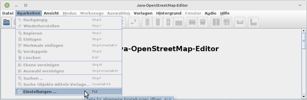
- To integrate the background maps into the JOSM editor, select “Edit” -> “Settings” from the editor’s menu:
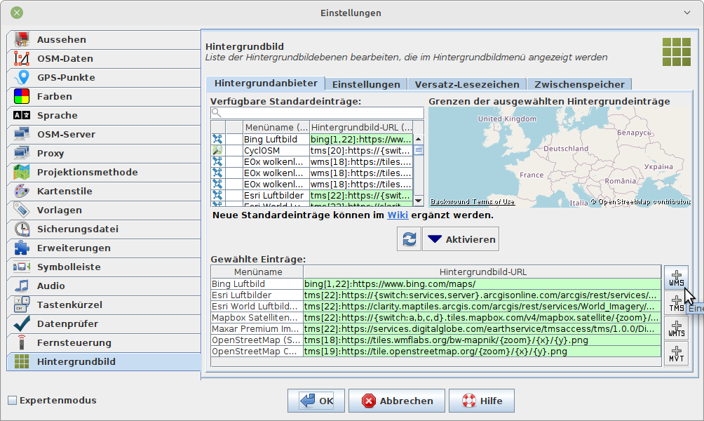
- In the “Settings” window that now appears, select “Background Image” from the tab list on the left.
- Then click on the button at the bottom right with the label “+ WMS”:
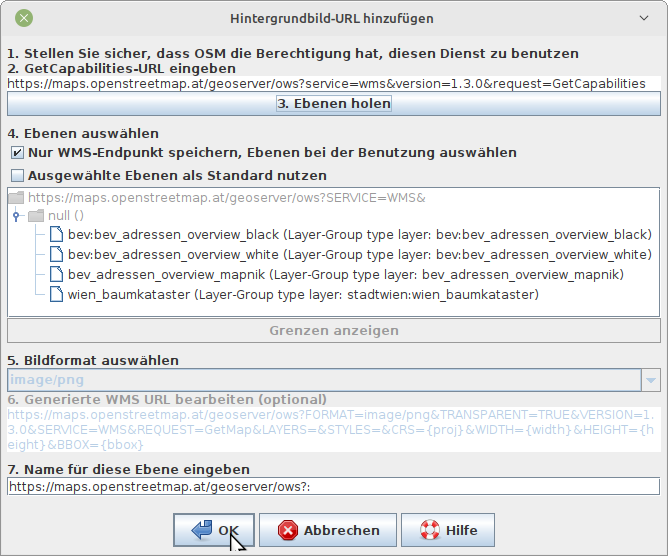
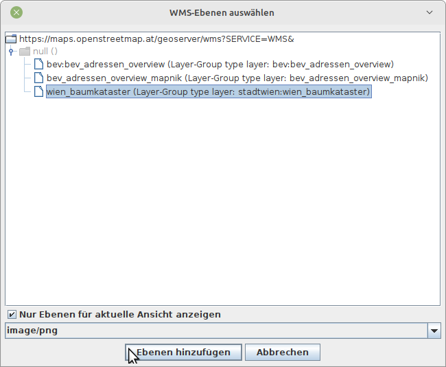
- Now the link to the background maps of the OSM-AT association can be added in the new window that appears under “2. Enter GetCapabilities URL” ("https://maps.openstreetmap.at/geoserver/ows? service=wms&version=1.1.1&request=GetCapabilities")
- Then click on “Get 2nd layers”. This loads the necessary metadata.
- Then check “Store WMS end point only, select layers when using”.
- Now you can close the window by clicking on “OK”, the service with the background maps is now stored in JOSM.
- Next, a few settings for displaying this background service should be adjusted so that it is displayed optimally. The following settings have proven to be advantageous. If labels are sometimes not displayed, you can experiment with the settings “Tile Zoom Offset” or “Tile Size”.
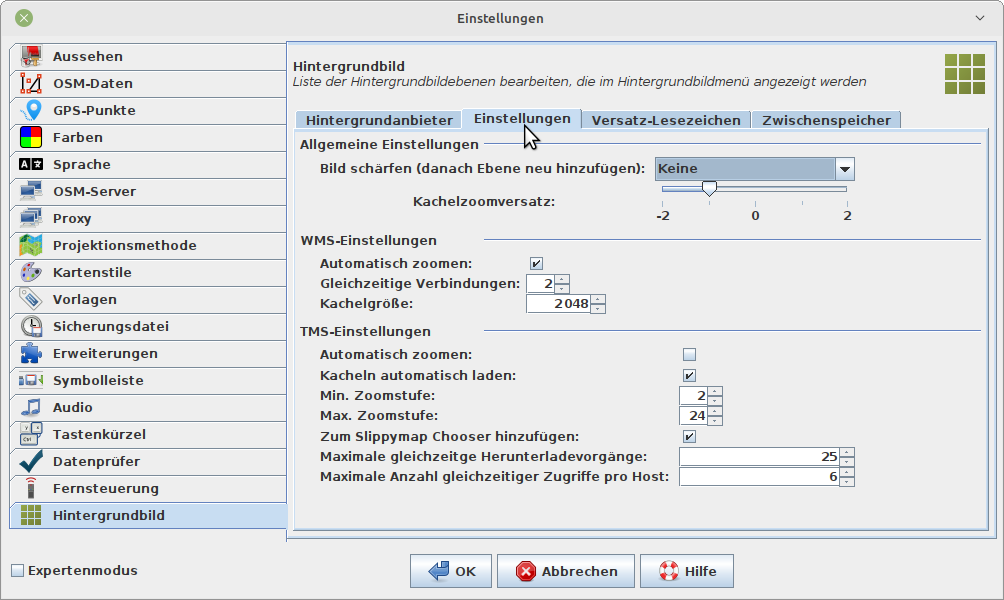
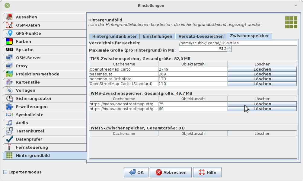
- Caution: after changing the settings, it may be necessary to clear the JOSM internal cache for background map services to see the changes:
Now the “Preferences” window can be closed.
To load one of the background maps into the JOSM editor, the following must be selected from the “Background” menu:
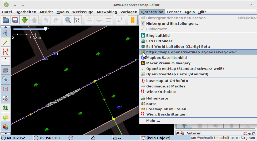
After that, a list of all available background maps appears:
The desired background map can now be selected and loaded into the JOSM editor by clicking on “Add layer”.
Available background maps
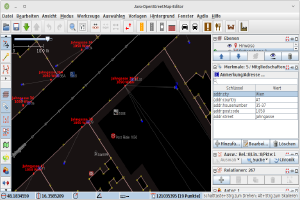
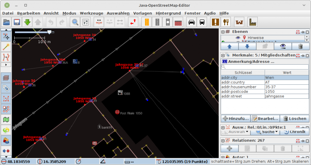
BEV address data set
This background map shows the Austria-wide officially valid address data released by the BEV (“Bundesamt für Eich- und Vermessungswesen”). These were obtained from this URL: https://www.bev.gv.at/portal/page?_pageid=713,2601271&_dad=portal&_schema=PORTAL
This background map displays data with the cut-off date of October 1, 2021.
There is always a “property address”, which is shown in red in the background map, and possibly one or more “building addresses” assigned to it, which are shown in blue in the background map. A gray arrow shows the assignment. For example, it is possible that a building address is referenced by two different property addresses. This is the case, for example, when an entrance has two different addresses at the same time.
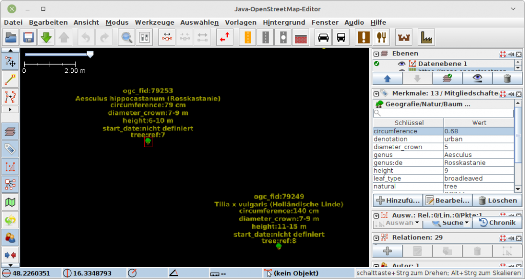
City of Vienna Tree Register
The data of the tree cadastre of the city of Vienna can be found at https://www.data.gv.at/katalog/dataset/stadt-wien_baumkatasterderstadtwien.
The data was last downloaded on February 12, 2022.
This background map shows the information relevant for the OpenStreetMap and already tagged as such: all trees in the City of Vienna’s tree cadastre.