Projekte

OSM-AT background maps

OSM-AT background maps

Scubbx
Translations: DE

To make it easier to enter and update various external data in OpenStreetMap, the Austrian OpenStreetMap Association offers a number of background maps that can be displayed in the usual OSM editors and provide important information about objects to be entered.

These background maps can be accessed via the following WMS interface: https://maps.openstreetmap.at/geoserver/ows?service=wms&version=1.1.1&request=GetCapabilities

If you have any questions or problems, please contact the OSM mailing list at talk-at@openstreetmap.org or directly info@openstreetmap.at.

Integrating background maps
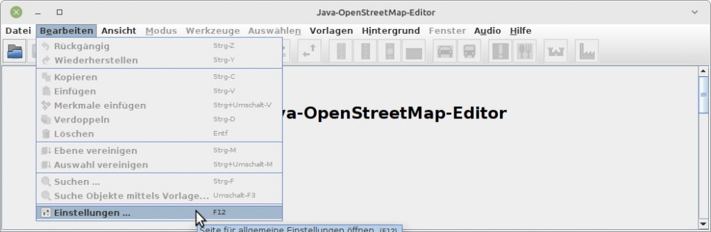
JOSM

  • To integrate the background maps into the JOSM editor, select “Edit” -> “Settings” from the editor’s menu:

OGD Wikimedia OpenStreetMap Checker

OGD Wikimedia OpenStreetMap Checker

Plepe
Translations: DE

I wrote a small tool that helps to synchronize OGD data sets with Wikimedia (Wikipedia, Wikimedia Commons, Wikidata) and OpenStreetMap. It can be found on this server: https://www.openstreetmap.at/checker.

Since the tool is not entirely self-explanatory, I made a small explanatory video:

https://www.youtube.com/watch?v=e9Is-3ssA7U

The source code can be found on Github. I welcome comments, ideas and code contributions!

Update: Meanwhile, there is a second screencast for this program, this time it is about how to install the checker yourself and how to expand it with additional data sets: